
Westerville ZIP Code Coverage
USPS lists three ZIP routes in its Westerville sorting and labeling scheme: 43081, 43082, and 43086. They serve different postal roles, but a delivery code is not a deed, court, election, or city-limit boundary. The City tells residents to use the county auditor's tax district for the relevant parcel. That is the practical first check after a postal lookup, especially where a Westerville mailing address could lie in either Franklin or Delaware County.
| ZIP | Postal role supported by the source | Post office or verifier | Research boundary |
|---|---|---|---|
| 43081 | Westerville postal service area; City directs Franklin County tax-jurisdiction checks for this ZIP | State Street Station, 260 S. State St.; USPS address lookup | Use the Franklin Auditor tax district, not the ZIP alone |
| 43082 | Westerville postal service area; City directs Delaware County tax-jurisdiction checks for this ZIP | McCorkle Boulevard location, 617 McCorkle Blvd.; USPS address lookup | Use the Delaware Auditor tax district, not the ZIP alone |
| 43086 | Westerville P.O. Box and mailing route designation | USPS lookup and City mailing examples | Treat as a box or mailing ZIP unless a specific street result confirms otherwise |
Those routes are a starting point for delivery and parcel research. They do not identify an entire city neighborhood, establish a court or recorder custodian, or show who occupies an address.
Westerville Postal Routes and Delivery Geography
The central Westerville postal quirk is that postal geography and public-record geography answer different questions. The City warns that a mailing address, post office, or school district does not always match the taxing jurisdiction where a person lives. Its Charter places Westerville in both Franklin and Delaware counties. A ZIP can therefore sit beside, rather than define, the county that holds the parcel, deed, court, or election record.
This is not a technical detail. The City directs 43081 searches to the Franklin County Auditor tax district and 43082 searches to the Delaware County Auditor tax district. The comparison becomes clearer when a postal label is treated as an address-verification clue and the auditor parcel card as the jurisdiction decision. A school name, a city mailing line, and a delivery code are all weaker than the parcel result for this task.
Parcel first. For Westerville record research, use the verified street address to find the county auditor parcel and tax district before choosing a recorder, court, or election office.
Verify a Westerville Delivery Code with USPS
USPS address lookup is the delivery verifier for a particular address. It offers address, city-and-state, and cities-by-ZIP routes. The tool itself warns that an address result does not confirm a named person or company is actually at that address. Use it to standardize delivery information, then move to an auditor or other official custodian only when a record question remains.
| Company | Optional text field in address mode |
|---|---|
| Street Address | Required for an address lookup |
| Apt/Suite/Other | Optional unit detail for disambiguation |
| City | Required in city-and-state mode; conditional in address mode |
| State | Dropdown, including Ohio; required in city-and-state mode |
| ZIP Code | Optional with an address; a five-digit ZIP is required for Cities by ZIP Code |
| Find | Submits the selected lookup |
The official USPS lookup interface is the source for the delivery check.
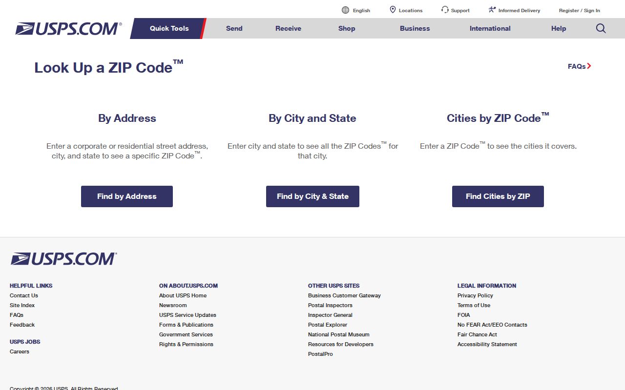
The screen supports postal verification, not a claim about the person, business, city-limit status, or county connected with an address.
Find Westerville Records in One Postal Area
A ZIP can narrow the path to a known address, but it does not create a ZIP-wide list of residents. Begin with delivery verification and use the address to identify the right county parcel. Delaware Auditor GIS documents that a user may type a ZIP or city in its Address field to generate property results. Franklin Auditor property search shows Owner, Address, Parcel ID, Subdivision/Condo, Map, and Intersection modes, with no verified dedicated ZIP filter. Results are property records, not a household roster.
- Use USPS to verify the address and its delivery route.
- For a 43081 address, open the Franklin County Auditor property search and use the address result to find the parcel and tax district.
- For a 43082 address, use Delaware County Auditor GIS; its Address field can accept a city or ZIP to produce property results.
- Record the exact situs address, parcel ID, tax district, and county before selecting a recorder or court portal.
- Use the property result only for what it displays. It does not establish every occupant or a current household.
Once the postal route has narrowed the address, the Westerville streets workflow is the appropriate route for parcel and deed steps by address.
Westerville 43081 and Franklin Parcels
The City points 43081 property-tax questions toward the Franklin County Auditor and its Tax District field. Franklin's property search accepts owner name, street address, parcel ID, subdivision or condominium, map, and intersection searches. A result can show the parcel ID, situs address, displayed owner, mailing address, transfer clues, legal description, tax district, value, and exemptions. Capture the parcel identifier and legal description before moving to the Recorder.
Franklin Recorder does not index by street address. The usable chain is address at the Auditor, then parcel number and legal-description clues at the Recorder. A mailing address can belong to a trustee, business, post office box, or other location. It is a tax-bill destination, not proof that an owner occupies the parcel, and property ownership does not identify unlisted occupants.
Note: A 43081 result helps route a parcel search, but Franklin County custody must be confirmed on the actual auditor record.
Westerville 43082 and Delaware Parcels
The City directs 43082 property-tax questions to the Delaware County Auditor, where Tax District is the relevant local field. Delaware's mobile GIS documents searches by Address, Owner Name, Parcel Number, Facility Name, and Subdivision Name. The desktop GIS provides Property, Subdivision, Intersection, Advanced, and Sales Search menus. Its address handling can use a city or ZIP as a way to generate property results, but the result still needs an exact parcel review.
After the parcel establishes Delaware County, the Delaware County Recorder is the deed route. The Recorder advisory states that deeds recorded after 1990 may be viewed or printed online without charge. Earlier images require office or counter research, supported by grantor or grantee, approximate recording date, book and page if known, and legal-description details. The postal route does not replace those document keys.
Westerville 43086 as a Mailing Route
Westerville City documents use 43086 for City P.O. Box addresses, including P.O. Box 6107. That documented use, together with USPS sorting information, supports treating 43086 as a post-office or box mailing designation. It should not be presented as a blanket residential city-limit zone. A street-specific USPS result is needed before assigning a delivery ZIP to a physical address.
This is the clearest comparison among the three local ZIP codes. 43081 and 43082 help route county tax-district checks for a physical parcel. 43086 is documented through city mailing examples and postal sorting. All three are postal classifications first. None alone establishes who lives at an address.
When a letter, city document, or archive citation gives only a box address, preserve it as mailing evidence and look for a separate physical-location record. The two Westerville post-office locations identified by the City are State Street Station at 260 S. State St. and the McCorkle Boulevard location at 617 McCorkle Blvd. Neither location converts a box route into a parcel, tax district, or resident record.
Westerville Postal Boundaries and City Limits
A Westerville delivery code does not prove City limits. The City provides an “Am I in Westerville City Limits?” path and directs residents to the appropriate auditor Tax District. That combination, not a postal label, is the correct check for municipal status. It also prevents the common mistake of sending a deed, probate, voter, or court question to the wrong county office in a city split between Franklin and Delaware counties.
The terms below keep the records keys separate:
- ZIP
- A USPS delivery-routing code, normally five digits.
- ZIP+4
- An added delivery segment that refines mail routing; it does not identify a parcel owner or city-limit status.
- P.O. Box ZIP
- A postal designation associated with box or mailing service rather than proof of a physical residence.
- Carrier route
- A mail-delivery sequence, not a public-records jurisdiction or household list.
For a city-limit question, use the audited parcel result. For mail delivery, use USPS. They are different answers to different questions.
Westerville Postal Results Need Parcel Keys
Four identifiers often appear together but should not be merged. A situs address is the physical parcel location used by auditors, GIS, and permit systems. A mailing address is where tax or other correspondence goes and may differ. A legal description is the lot, block, subdivision, or metes-and-bounds text that keeps land history continuous when street names or numbers change. A parcel ID is the county Auditor's local identifier.
In Westerville, those distinctions have special value because city growth, annexation, county boundaries, and postal zones do not line up perfectly. A ZIP result can start the search. The parcel ID and legal description are safer long-term controls when moving through county records.
Westerville Postal Research Follows County Custody
County boundaries drive the record custodian, not the post office. Franklin and Delaware maintain separate auditor, recorder, probate, court, and election systems. A Westerville mailing address is only the first clue. Establish the parcel county, then select the correct office and preserve the address, tax district, parcel ID, and date used in the search. That simple routine reduces false matches and keeps a ZIP code directory search within what postal information can truly confirm.
Note: USPS confirms delivery coding, while the county auditor establishes the parcel context needed for local records research.