
Trace a Westerville Street by Address
Use one exact Westerville address first, not a broad street-name guess. The City sits in Franklin and Delaware counties, and the county line determines the Auditor, Recorder, court, and election office that keep the relevant records. The City directs 43081 property research to the Franklin County Auditor and 43082 research to the Delaware County Auditor, while also warning that a mailing address, post office, or school district may not match tax jurisdiction. An auditor result is therefore the starting point for a street directory search, not a conclusion about a household.
Record the parcel ID, exact situs, displayed owner, tax district, transfer clue, and legal-description or subdivision wording. Then carry those identifiers forward. A parcel card supports a land and tax relationship. It does not identify every person at an address.
- Search the exact address in the appropriate county Auditor system and capture the parcel ID and legal description.
- Open the parcel in the county GIS viewer to see its boundary and the adjoining parcels or street segment.
- Use the parcel ID, named parties, subdivision, or legal description in the matching Recorder search.
- Read the latest deed and search the seller as a prior grantee to move backward through the land trail.
- Use a targeted City permit request or Museum catalog search only when the address history needs another dated source.
Note: A Westerville mailing label does not select the county custodian, so verify the parcel county before opening any county record.
Westerville Streets Need a County Check
Franklin and Delaware provide different but parallel address routes. Franklin County's property search starts with Owner Name, Address, Parcel ID, Subdivision & Condo, Map Search, or Intersection Search. Delaware County's desktop GIS provides Property, Subdivision, Intersection, Advanced, and Sales Search menus; its mobile GIS separates Address, Owner Name, Parcel Number, Facility Name, and Subdivision Name. Both can establish the parcel county and a land-record key. Neither system turns a mailing-city search into a complete roster of people along a Westerville street.
For a Delaware County parcel, use the Auditor GIS result before going to the Recorder. Delaware's Recorder advisory says recorded deeds from 1990 forward may be viewed and printed online, while earlier material needs an office or counter route. For a Franklin parcel, use the Auditor result before searching the Recorder because the Recorder does not index by street address. The two-county split is a records-geography fact, not a technical detail.
Westerville Street Directory Auditor Fields
Franklin's property portal is particularly useful for moving from an address to a parcel. Its parcel-ID mode accepts all or part of a number without dashes, permits an asterisk for a group of parcels, and may return up to 500 matches when an exact match is unavailable. Narrow a common street or owner result before choosing a card. Retain the parcel ID and transfer clue for the Recorder search rather than relying on a displayed name alone.
| Franklin Auditor control | How it helps an address search | Format or limit |
|---|---|---|
| Address | Bridges a street address to a parcel result | Use the exact street number when available |
| Parcel ID | Returns a specific land-record key | No dashes; partial values and an asterisk are accepted |
| Subdivision & Condo | Finds a development or condominium context | Useful when the legal description names a subdivision |
| Map Search | Opens a spatial entry point | Confirm each result against its parcel card |
| Intersection Search | Helps orient a street segment | It is not an occupancy search |
The Franklin County Auditor property search supplies the address-facing bridge for a Franklin County Westerville street. Treat its inventory as a lead that should be checked against the recorded instrument.
Westerville Street Records by Address
Several official record sets can be keyed to the same parcel or address, but they answer different questions. The auditor card supplies the present land-tax view. GIS places it among parcels. Recorder instruments preserve the land-document chain. Planning files can date a project or address assignment. Museum material can put an older address in local context. Combining those layers is more useful than treating any single search as a street directory of current residents.
| Address record | Custodian | What it may establish | Access path |
|---|---|---|---|
| Parcel card | Franklin or Delaware Auditor | Parcel, situs, owner display, mailing clue, tax district, and transfer detail | County property portal |
| Parcel map | County Auditor GIS or City GIS | Boundaries, nearby parcels, layers, and tax or administrative context | Viewer or GIS hub |
| Deed, lien, release, or plat | Recorder for the parcel county | Named parties, recording date, document number, and legal description | Online index, counter, or copy request |
| Permit or address file | Westerville Planning or another proper jurisdiction | Project, application, inspection, or address-assignment chronology | Portal or narrow public-record request |
| Historic local material | Westerville History Museum | Maps, obituaries, house images, or historical context | Catalog search and staff assistance |
Note: A parcel map shows land features and boundaries, while the auditor card is the better place to confirm the displayed tax-record information.
Westerville's Address-Index Quirk
Franklin Recorder expressly says that a street address is not an index value. That is the practical quirk behind a careful Westerville street directory search: address to Auditor, Auditor to parcel number, then parcel number or legal-description clue to Recorder. The Recorder's Cloud Search can take a party name, subdivision, document type, document number, or other search term, then narrow by recorded date. Its indexed scope searches structured index information; its full-text OCR scope searches document contents as a phrase when more than one word is entered.
OCR can expose an address inside a scanned document, but an OCR hit is only a lead. Confirm the instrument number, recorded date, named parties, and legal description. The Recorder's legacy system also holds Franklin deed indexes from 1804 through 1913. Those historical index books help a past-address investigation, yet they still require the underlying record and legal-description check.
A screen from the Franklin County Recorder public-records search guidance illustrates the official route into Cloud and Legacy searches.
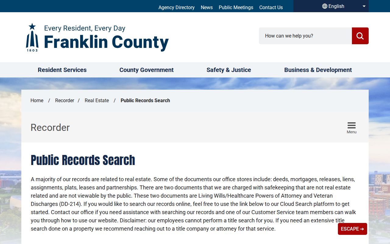
The guidance belongs after the parcel step, because it describes document research rather than a direct street-address index.
Map a Westerville Street Segment
For a defined Franklin County street segment, use Parcel Viewer rather than manually guessing which lots sit together. The official viewer offers By Shape, By Value, By Spatial, and Results tabs. By Shape lets a user draw an area. By Spatial begins with a found parcel, then applies a chosen distance and selects parcels entirely within or intersecting the buffer. Results can be exported as CSV through the three-dot menu. Identify can return map features with a link back to property search, while Layer List controls the layers shown.
Start small. Find the focal parcel, use a short buffer or draw only the intended segment, note each parcel ID, and open the individual cards. That creates a repeatable street-by-street parcel inventory. It does not identify every resident of those parcels.
The Franklin County Parcel Viewer shows the map tools used for a Westerville street segment.
Use the viewer's parcel results as a map of land records, then verify a selected parcel through the Auditor and Recorder.
Westerville Street Record Terms
Address records often use terms that look alike but carry different meanings. Keeping them separate prevents a street directory search from treating a tax mailing destination or a map label as a statement of residence.
- Parcel
- A county land-tax unit with its own identifier, boundary, and property-record entry.
- Situs address
- The physical location of the land. It can differ from the address where tax mail is sent.
- Plat
- A recorded map that lays out lots, blocks, streets, or subdivisions.
- Legal description
- The lot, subdivision, or metes-and-bounds wording that carries land identity across deed transfers.
- Grantor and grantee
- The party conveying an interest and the party receiving it in a recorded document.
Delaware's address route is also parcel-led. Its Recorder has an online path for post-1990 document images and an office route for earlier material. A search result from either county needs the matching legal description before it is joined to a Westerville street history.
Follow Westerville Street Deed Chains
A deed chain moves from the current parcel to the most recent instrument and then back through earlier transfers. Start with the auditor's parcel ID, owner display, transfer date, and legal-description clue. Find the latest deed in the appropriate Recorder system. The seller on that deed is the grantor. Search that person or entity as a prior grantee, then compare the legal description before stepping back again. Mortgages, releases, plats, probate transfers, and name changes can explain a break in the apparent sequence.
For Delaware County Westerville parcels, the Delaware County Recorder records-search guidance explains the county's online and office channels.
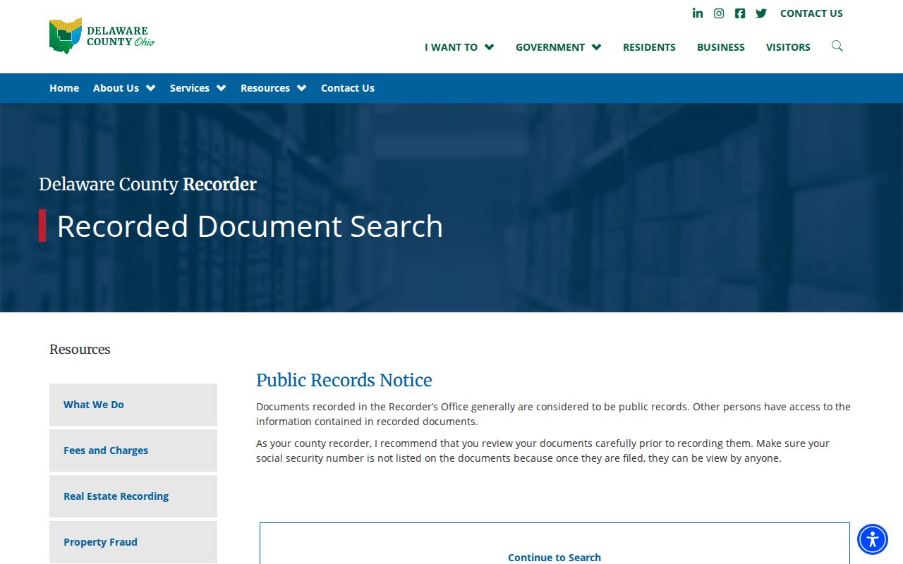
The Delaware route is useful after the county parcel is established, especially because earlier documents may need counter assistance.
Staff can explain operation of a Recorder search but do not perform extensive title work. Where a legal conclusion about title is necessary, retain the actual records and obtain appropriate professional advice.
Date Westerville Streets With Permit Files
Westerville Planning & Development is the municipal source for address assignment and many project records. The published permit route lists planning, zoning, and building-review applications, and says that a new building or utility structure needs an Address Request Form before a permit application. That makes the address-assignment record a useful physical-history clue. The portal is an application channel, not an open resident roster.
For a past project, ask Planning or the Clerk of Council for an existing final permit, application, inspection result, or address-assignment file for a stated situs and date range. The City's records policy permits an oral request under Ohio's Public Records Act, R.C. 149.43, although a custodian may ask that an ambiguous request be narrowed. City-edge parcels may fall under another jurisdiction, so confirm tax district and city-limit information before directing the request.
Note: A permit can name an applicant or contractor, but that field documents a project role and does not prove household occupancy.
Westerville Street History Has Extra Keys
For an older street or house, search the Westerville History Museum catalog with a street name, cross street, surname, school, business, subdivision, or alternate road form. The Museum's unified collection spans materials from the 1800s to the present, including maps, house and business photographs, obituaries, wedding announcements, oral histories, and other local records. Its documented 1913 Westerville Directory is held in File on Directories D10, but no verified complete local reverse-directory run was found. Ask Museum staff for the exact year, publisher, and whether an address or reverse section exists.
Historic maps can help date a building footprint or identify a former place name. They do not name a continuous household. Pair any map result with a parcel legal description, deed, dated directory or newspaper item. For a focused historical household trail, the Westerville city directory collections offer the local archive route without turning the current street method into a generic directory search.
Westerville Street Records Have Limits
A Westerville street directory can show public land and document relationships, not a verified list of everyone in each home. Auditor cards may show a taxable owner and a mailing destination. Deeds may show parties to a transaction. GIS shows parcels. None of those sources establishes every household member or non-owner occupant. Ohio's individual voter lookup is not a reverse street search, and voter records remain subject to statutory confidentiality protections.
Safe at Home participants and other protected records must not be reconstructed from partial data. Driver and motor-vehicle personal information is restricted, and utility customer accounts are not a public street roster. If the factual land record is wrong, contact the county Auditor or Recorder that holds it instead of repeating the error.
Lawful use. Westerville address records support personal, civic, family-history, and property research. Do not use them to stalk, harass, intimidate, or harm anyone.